Difference between Snow, Sleet, Freezing rain, Graupel, Hail, Rain and Drizzle (Precipitation)!
Precipitation is one of the steps in the water cycle in which the clouds gets transformed into some sort of particles under condensation and falls over the earth by gravity. The rising warm air molecules from the earth, due to the heating of the sun are generally cooled (condensed) on the upper atmosphere and made to fall on the earth. The condensed air molecules in the sky fall on the earth under many categories depending upon the atmospheric temperature and pressure. This precipitation can be classified into solid precipitation and liquid precipitation.
 |
Different forms of precipitation |
Solid precipitation
- Snow
- Sleet
- Freezing rain
- Graupel
- Hail
Liquid Precipitation
- Rain and drizzle
All these forms of precipitation begin with the cloud. There are different types of clouds categorized by their shape and height. They are Cirrus clouds, cumulus clouds, stratus clouds and nimbus clouds. A combination of the above clouds is also available namely cirrocumulus, nimbostratus, cumulonimbus, cirrostratus, altostratus and altocumulus.

As shown in the figure, the cirrocumulus, cirrus and cirrostratus are high-level clouds ranging from 5 to13 km in altitude. Altocumulus, altostratus and nimbostratus are mid-level clouds, ranging from 2-7 km in altitude. Stratus, cumulus, cumulonimbus and stratocumulus are low-level clouds ranging from 0-2 km in altitude. Among these clouds, the nimbostratus and the cumulonimbus provide a major amount of precipitation to the earth. Other types of clouds may also bring some amount of precipitation. All these clouds provide one kind of precipitation, called snow; and they classify into different types depending upon the atmospheric temperature and pressure. Let’s see about each of the precipitations of the cloud in detail, but before that let’s see how a cloud is formed.

A cloud is a collection of water droplets, dry air and some dust called condensation nuclei (aerosols). These dust particles exist in very small sizes, particularly in 1 micron. At first, for a cloud to form, the sun begins the process by warming the surface. This heating process causes the water on the surface, to get converted into water vapour. This process is called evaporation. As this water vapour is warm, it rises up due to its low density. The sun also heats the surface air on the ground and makes it to rise too. As the warmer air rises, it also takes up some dust particles with it. These rising air molecules begin to cool due to the drop in temperature at the higher altitude of the atmosphere. Because with the increase in altitude, there will be less air over the place which causes a lower pressure. So the air molecules expand, thereby increasing the surface area and causing the temperature to decrease. This cooling of water vapour again converts the water vapour into liquid by the process of condensation.
 |
Formation of Cloud |
The condensation happens over the dust particles, making them together as a water droplet. These water droplets freeze as ice crystals, due to the freezing temperature in the cloud. These small crystals get suspended in the air due to their low mass. When more and more air molecules rise, it causes more and more water droplets and crystals and dust particles and water vapour in the higher atmosphere, thus making it together as a cloud. There are generally three types, in which these precipitating clouds form in the atmosphere to bring precipitation. They are,
- Convective precipitation
- Orographic precipitation
- Cyclonic precipitation
Convective precipitation

Convective precipitation is a form of precipitation in which the warmer air rises over the atmosphere and precipitates by cooling. It is the general form of precipitation. The term convection refers to the mode of heat transfer in which the warmer air rises and sinks back by getting cooled again. This can be also seen inside the earth’s mantle where the molten lava rises up by getting heated and sinks back to the mantle thereby creating convection currents, which creates the earth’s magnetic field. This type of precipitation particularly occurs in the northern hemisphere where there is more land; because land gets quickly heated than water. Thus more warm air is produced on the continental side, leading to more rainfall. Convective precipitation usually lasts for a few minutes with irregular precipitation and it is usually accompanied by the sun, as it needs heat to make precipitation.
 |
Convective Precipitation |
Orographic precipitation is formed when the warm air is raised over the atmosphere by colliding with the mountain slopes. This leads to the cooling of the warm air to form clouds, thereby beginning to precipitate. This colliding of air with the mountain slopes is generally referred to as the Orographic process. This process can simply be pretended to be the orogenic process as it deals with the mountains. An orogenic process is a type of process which deals with the origination of mountains by the collision of continental plates. So this rising of mountains caused by the orogenic process can cause the air to lift and can cause the precipitation called orographic precipitation. The rising warm air flows upwards through the mountains, due to the wind force. Also, as the mountains get heated and cooled quickly, the warm air rising from other surfaces also, will flow towards the mountain top according to the second law of thermodynamics, (which says that the heat will move from the higher concentration to the lower concentration). The rising air in the mountains mostly happens on the windward side (upward side) of the mountain than on the leeward side (downward side) of the mountain. This rising of air causes the formation of clouds at the top of the mountain. Also, some of the air rising through the mountain descends through the mountain thereby getting warm again due to the decrease in the altitude. This descending warm air takes up all the moisture in the ground, which in turn does not create any cloud on that side of the mountain. The descending side of the mountain is called as the rain shadow region, due to the presence of clouds on the other side. The operation can be clearly observed from the below figure. The orographic precipitation can be seen in the places of mountains; particularly in the Western Ghats and in Himalayan regions of India.
 |
Orographic Precipitation |
Cyclonic precipitation
Cyclonic precipitations are mainly caused by cyclones. A cyclone is a movement of heavy clouds in a circular pattern, due to the difference in the pressure. The pressure difference is caused by the differential heating of the surface by the sun. This differential heating causes high-pressure areas, by the sinking of cold air and low-pressure areas, by the rising of warm air. When these two pressurized areas come in contact (not mixing), it creates a front. To know in detail how cyclones are formed please visit my previous post,
https://sciencetopic03.blogspot.com/2021/12/what-causes-winds-science-behind.html
There will be generally two fronts created; namely warm front and cold front. Here the warm air surpasses the cold air through the warm front, as the warm air has the least density. This warm air gets cooled, as it gets to a higher altitude; due to which it condensates and converts into clouds, thus bringing precipitation called cyclonic precipitation. The process has been clearly depicted in the below picture.
 |
Cyclonic Precipitation |
Let’s now see the different types of precipitation.
Snow

Snow is a white puffy thing that everyone likes. It is also a form of water that usually forms when the temperature in the cloud is below freezing. When the temperature is below freezing in the cloud, then the condensing water vapour will turn into solid (ice crystal). These ice crystals form the base of the snowflakes. As the crystal wobbles around the cloud, it collides with other crystals and generates a beautiful pattern of water called the snowflake. If the snowflake coming out of the cloud passes through warmer air, then the snow melts and gets converted into rain or sleet. If the flakes travel through a moist air that is slightly above 0°C then the snowflakes will convert into large snowflakes. If the flakes pass through cold and dry air then the flakes will not combine together and get in a powdery form.
 |
Formation of Snowflakes |
A general science of the snowflakes is, that no two snowflakes are the same; thereby each having its own distinguished shapes. In 1988, Nancy Knight, a scientist, discovered that two snowflakes are the same with identical shape and mass. But if we look deep into the chemical structure of the ice, some of the atoms in the ice particle may be deuterium in various places. This gives that no two snowflakes are identical. To know more about the science of snowflakes please visit the link,
 |
Credit (Different shapes of snowflakes): By Annatsach - Own work, CC BY-SA 4.0, https://commons.wikimedia.org/w/index.php?curid=76321360 |
Sleet
Sleet is a form of frozen water droplet that usually starts from the cloud as snow, by the collision of ice crystals. These snowflakes, when passed through the layer of warm air, the snow melts and transform into raindrops. This warm air is caused by the rising air molecules from the ground due to the heating of the sun. So that the warmer air stays at a higher altitude while the colder air stays at a lower altitude. But with even increasing with altitude, the temperature goes on decreasing. So the temperature on the surface of the ground is low and goes on increasing and decreasing with the increase in altitude. The density of the warmer air forming just above the cold surface on the ground depends upon the rate of heating of the sun. Now when the snowflake melts and turns into a raindrop, it travels towards the earth and again converts into ice by passing into a layer of cold air that is at or below freezing level (0°C). The layer of freezing air should be at a certain level to form sleet. This sleet will fall on the ground as small ice pellets.
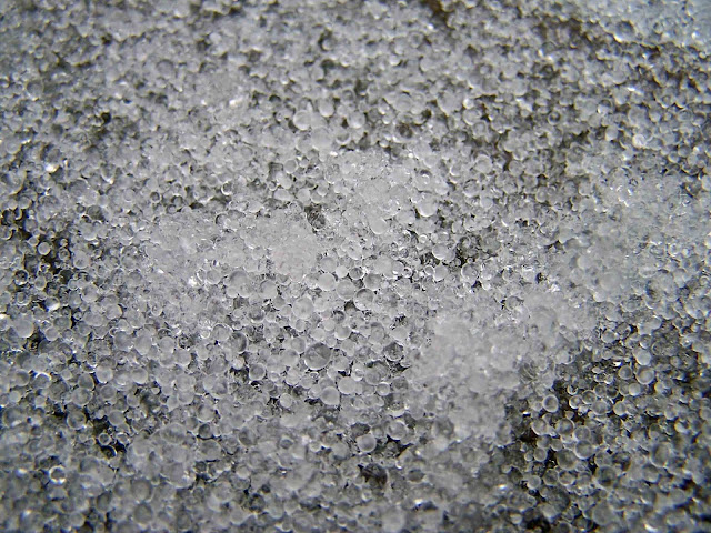 |
Credit (Sleet): By mike epp - originally posted to Flickr as Sleet, CC BY 2.0, https://commons.wikimedia.org/w/index.php?curid=3783116 |
Freezing rain
Freezing rain is a form of rain that falls on the surface of the earth and freezes on the objects on the ground. Freezing rain also starts its journey from the cloud as snow, because the temperature in the cloud is always below freezing due to its higher altitude. So the water droplets present in the cloud will get frozen as ice crystals and always falls as snow. After passing through the layer of warm air, when the snow melts into rain, it again passes through a layer of cold air, to get the freezing rain. In the case of freezing rain situation, the layer of cold air at the lower area of the atmosphere will be small, compared to the layer of cold air in the formation of sleet. The layer of cold air will be always at a temperature below freezing. When the falling rain collides with any of the objects in the ground, it freezes on the object thereby causing the freezing rain.
 |
Credit (Freezing Rain): By Laslovarga - Own work, CC BY-SA 3.0, https://commons.wikimedia.org/w/index.php?curid=30290590 |
Graupel
Graupel is also a small ice pellet that forms when a supercooled water droplet suspended in the atmosphere freezes on the snowflakes. Graupel is a soft hail or snow pellet that is very soft and brittle. It always forms around a snowflake. Graupel usually forms in winter storms. As the snow begins to fall from the cloud, it may encounter with supercooled water droplets. These supercooled water droplets will get frozen on the snowflakes, by the process of accretion, which can be observed from the below figure. A snowflake that has frozen water droplets on its surface is called to be rimed. Riming is generally a process of freezing supercooled water droplets on any surface. As the snowflake keeps on growing it transforms into graupel.
 |
Credit (Graupel):By LiWei - Own work, CC BY-SA 4.0, https://commons.wikimedia.org/w/index.php?curid=66097898 |
Hail

Hail is also a type of small ice pellet like the graupel. But unlike graupel, the hail forms on hot summer days, and it is huge. During this summer day, very warm air and heavy air currents are created, which induces a strong updraft that forces under the cloud. These severe updrafts will cause the falling ice pellets from the cloud to go again to the top of the cloud, which could freeze the ice pellet again and make it to grow larger. Again the ice pellet starts to fall down, but due to the severe updraft, it again goes up and forms another layer of ice around the ice pellet. Likewise, several cycles are made, and the ice pellet keeps on increasing in size. At a point when the size of the pellet is much higher to get suspended, it comes down to the earth by the force of gravity as hail. When we cut the hail in half, we can view many layers of ice, which determines the number of cycles made by the ice pellet inside the cloud.
 |
Formation of Hailstone |
 |
Credit (Cycles made by the stone inside the cloud): By ERZ - Own work, CC BY-SA 3.0, https://commons.wikimedia.org/w/index.php?curid=5034217 |
Liquid Precipitation
Rain
Rain is a liquid form of precipitation that comes to the earth as water. When a cloud is formed in the atmosphere, there will be more crystals present in it. When there are more ice crystals in the cloud, it begins to combine together and gather mass. When the mass becomes greater than a point it begins to fall down to the ground, as snowflakes. When the atmospheric temperature is very high, the snow melts on the way to the earth, thereby making it as rainfall. These major rain clouds will be present in the very lower atmosphere and extend to very high altitudes.
 |
Rain |
A drizzle is also a form of rain that occurs in a tiny form. The water droplet in the drizzle is very tiny, and its diameter will be 0.5mm, while the droplet in the rain is 2mm. We can distinguish raining and drizzling by feeling the water droplets. If we can’t feel the water droplets falling from the cloud, then the process will be drizzling, meanwhile, if we can feel the raindrops then the process will be raining.
 |
Formation of different precipitation |
Written by [Jerine Victor]


Comments
Post a Comment